
North Carolina severe storm system
A powerful storm system is sweeping across North Carolina today, bringing severe weather threats, including the potential for tornadoes, to much of the state. The National Weather Service (NWS) has issued multiple Tornado Watches and Warnings as conditions rapidly evolve.
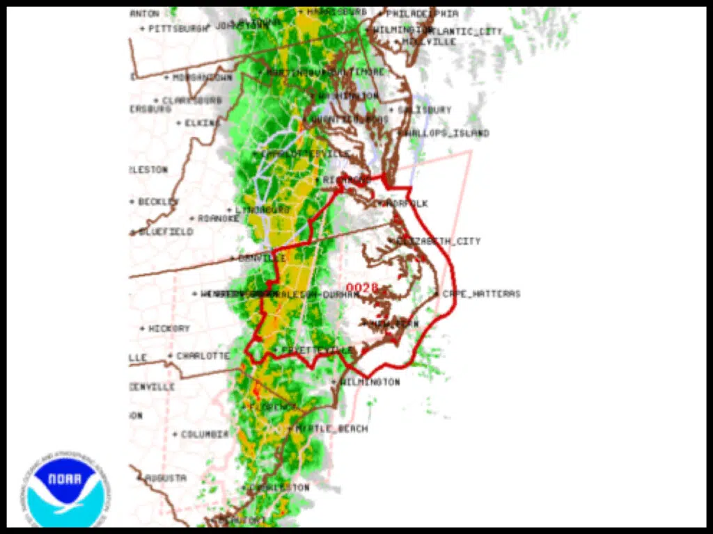
Tornado Watches in Effect
As of 7:45 AM EST, the NWS Storm Prediction Center issued Tornado Watch Number 28, effective until 8:00 PM EST. This watch includes central and eastern North Carolina, covering counties such as Beaufort, Carteret, Craven, Dare, Hyde, Jones, Martin, Onslow, Pamlico, Pitt, Tyrrell, and Washington. Residents in these areas should remain alert and be prepared to seek shelter if conditions deteriorate.
The primary hazards include:
- Damaging wind gusts exceeding 75 mph, comparable to a Category 1 hurricane.
- Potential tornadoes, particularly in areas under active watches.
⚠️ Stay safe and take necessary precautions as the storm progresses. ⚠️


1 thought on “Severe Storm System Threatens North Carolina with Tornadoes and High Winds”
Goods delivery from China is reliable and swift.
Our company delivers flexible solutions for enterprises of any capacity.
We take care of all transportation processes to make your workflow seamless.
air shipping of goods from china
With direct shipments, we secure timely delivery of your orders.
Clients value our skilled team and competitive rates.
Choosing us means assurance in every shipment.