North Carolina winter storm expected to bring ice, snow, and dangerous travel statewide
RALEIGH, N.C. — North Carolina is officially on high winter alert as a powerful and potentially crippling winter storm barrels toward the state this weekend, prompting winter storm watches, weather alerts, and a State of Emergency declaration from Governor Josh Stein.
Forecasters warn the storm could bring a dangerous mix of snow, sleet, and freezing rain from the Mountains through the Piedmont and into parts of eastern North Carolina — with ice, not snow, posing the biggest threat.
State officials say impacts could begin as early as Saturday afternoon and last into early Monday, with icy roads, power outages, and travel disruptions likely across much of the state.
WHO’S IN THE STORM’S PATH — REGIONS AT RISK
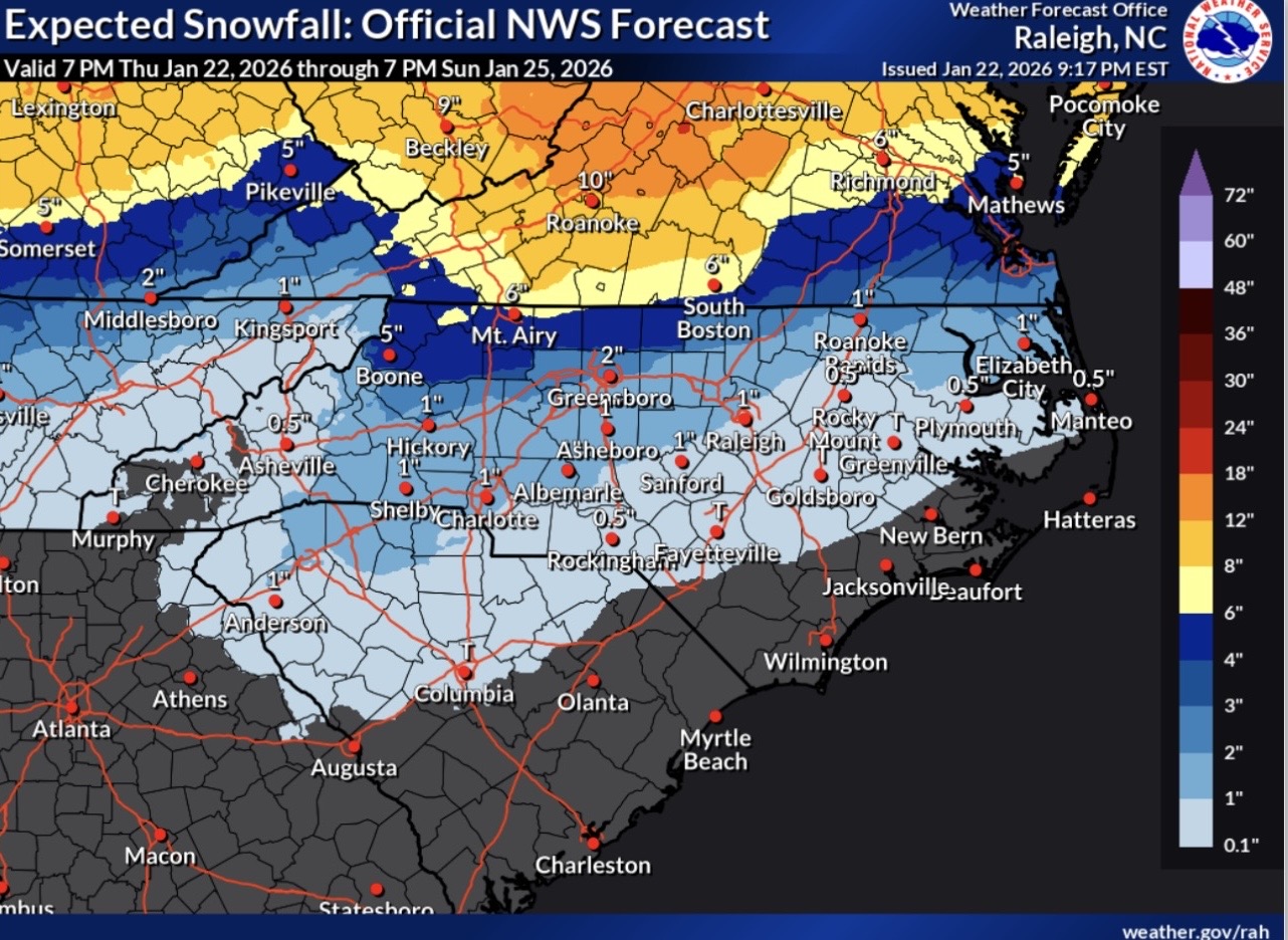
Nearly the entire state is in play, according to the National Weather Service and NC Emergency Management.
Western North Carolina & Mountains
Winter Storm Watches in effect
Areas including Asheville, Boone, and surrounding mountain counties are expected to see snow and sleet develop first, followed by freezing rain as warmer air pushes in aloft. Ice accumulation could weigh down trees and power lines.
Piedmont & Triad
High impact zone
Cities like Greensboro, Winston-Salem, High Point, Charlotte, and surrounding counties could see snow changing to sleet and freezing rain Saturday night, creating hazardous travel and a real risk of power outages.
Central North Carolina
Winter Storm Watches issued
The Raleigh–Durham, Fayetteville, and Sandhills regions are likely to see rain start as snow before turning into sleet and freezing rain.
Eastern North Carolina
Inland areas at risk
Inland eastern communities such as Rocky Mount, Goldsboro, Wilson, Plymouth, and Columbia may experience light snow followed by several hours of freezing rain. Coastal areas and the Outer Banks are expected to avoid the worst ice due to slightly warmer temperatures.
BIGGEST THREATS NORTH CAROLINIANS SHOULD PREPARE FOR
Ice Accumulation:
Forecasters warn 0.25 to 0.60 inches of ice is possible in some areas — enough to snap tree limbs and knock out power.
Dangerous Roads:
Snow, sleet, and freezing rain could leave drivers stranded. Officials urge residents to stay off the roads unless absolutely necessary.
Power Outages:
Utility crews are preparing, but multi-day outages are possible in areas with heavy ice.
Governor Josh Stein has declared a State of Emergency, activating the State Emergency Response Team and urging residents to prepare now.
Road crews are pre-treating highways and bridges statewide, but emergency officials say the safest plan is staying home once the storm begins.
WHAT YOU SHOULD DO NOW
- Fill up your gas tank
- Stock up on food, water, medications, and pet supplies
- Charge devices and have flashlights ready
- Prepare a plan for power outages
- Avoid unnecessary travel starting Saturday